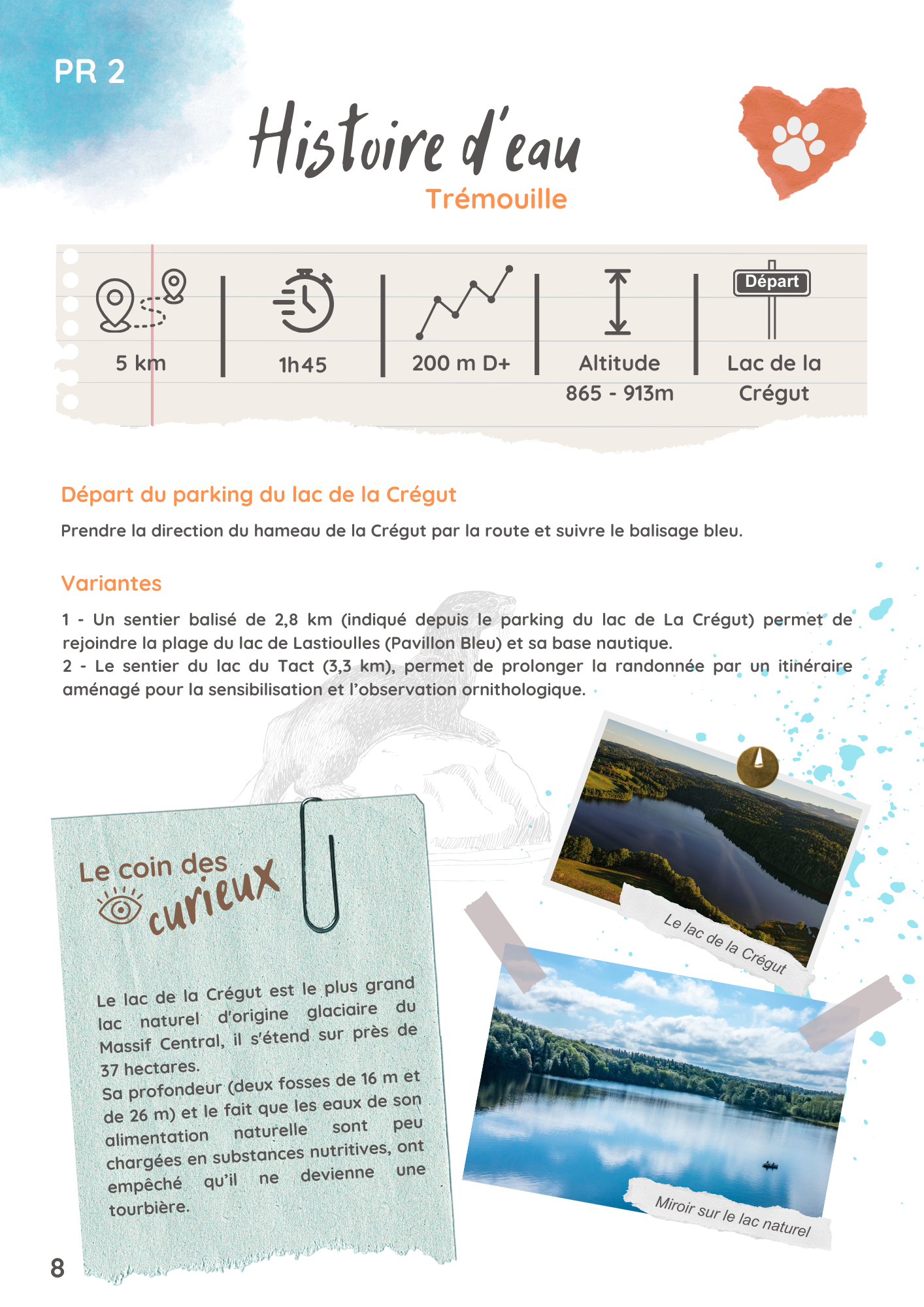
PR 2 : Histoire d’eau
Trémouille
Opening period
All year round daily.
Description
This easy hiking trail takes you around the Crégut natural lake to discover the unique landscapes of the Artense region, with its forests, meadows and panoramic views of the Cantal and Sancy mountains.
The Lac de la Crégut is the largest natural lake of glacial origin in the Massif Central, covering almost 37 hectares. Its depth (two pools of 16 m and 26 m) and the fact that its natural water supply is low in nutrients have prevented it from becoming a peat bog.
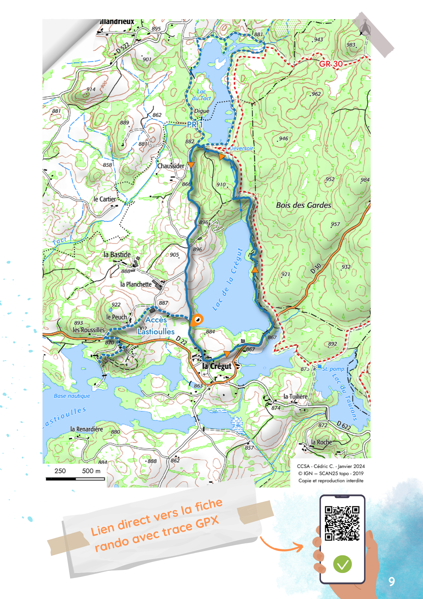
Departure point: Lac de la Crégut parking lot. Take the road towards the hamlet of Crégut and follow the blue markings.
Two variations are possible.
Variant n°1: A 2.8 km path (signposted from the Lac de la Crégut parking lot) leads to the beach of Lac de Lastioulles (Pavillon Bleu) and its nautical base.
Variant n°2: The Lac du Tact trail (3.3 km) extends the hike with an itinerary designed for birdwatching and awareness-raising.
Itinerary
5 km
1h45
200 m
Blue markings
Services
Equipment :
Car park
Free car park
Picnic area
Facilities for the disabled :
Adapted tourism
- Not accessible in a wheelchair
Pets :
Pets welcome
Prices
Free access.
Further information
Files to download
Location
Parking du lac de La Crégut
La Crégut
15270 Trémouille
La Crégut
15270 Trémouille
Things to doin the area
©
Crédits